On October 5, the US Forest Service announced that crews are working on building containment lines for the upcoming “North Aztec Springs prescribed fire” in the Santa Fe Municipal Watershed. The fire was recently slated to be ignited by the agency after Monday, October 16. However, in the October 13 public meeting in Santa Fe about the fire, the agency stated that the fire will not be ignited during the week of October 16 because of current weather forecasts and dry vegetation.
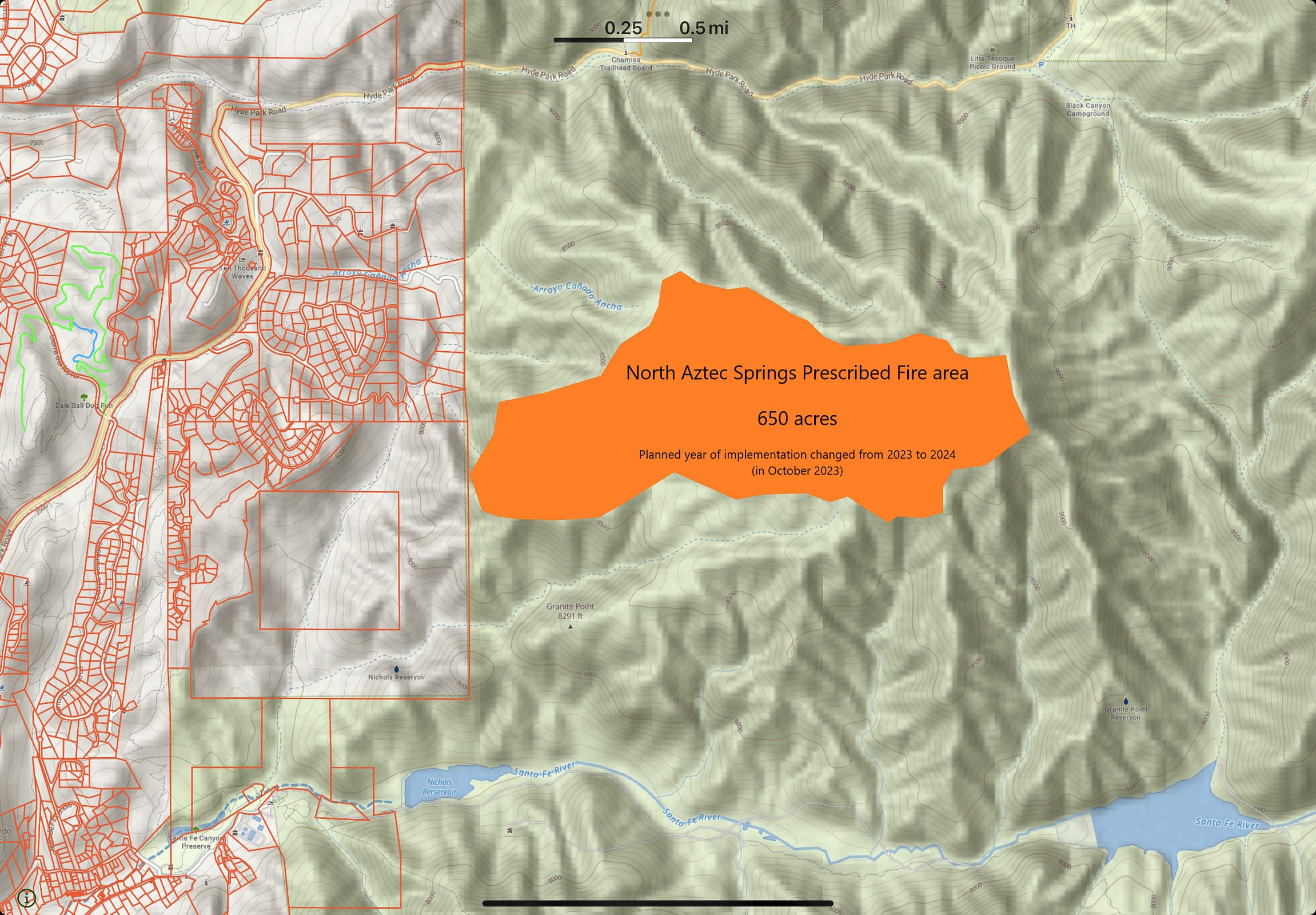
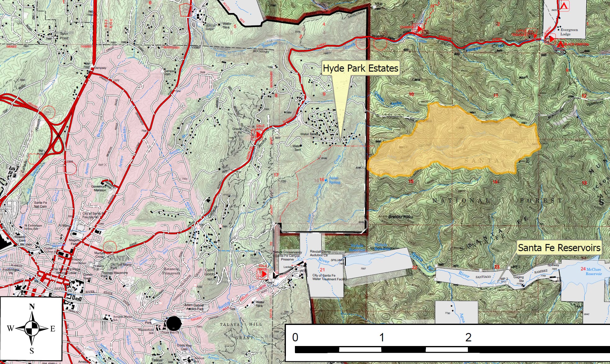
The fire is part of a land management strategy which the agency states is “centered on long-term forest health, including reducing forest fuels and using prescribed fire on the landscape.” The fire is intended to be limited to 650 acres just to the east of Santa Fe’s Hyde Park Estates neighborhood off of Hyde Park Road.
Over forty persons, many from communities proximate to the planned fire, attended the October 13 meeting, which was co-hosted by the Forest Service and the Greater Santa Fe Fireshed Coalition. Concerns raised about the planned fire included:
— the risk of escaped fire (as occurred as a result of three separate Forest Service burning projects last year in Santa Fe National Forest)
— the lack of evacuation plans for nearby communities in case of escaped fire
— insufficient public notice about the two public meetings scheduled about the planned fire
— a closed lane on two-lane Hyde Park Road which is the only egress for numerous residents, caused by an ongoing PNM project
— the existence of flammable years-old slash piles by the area to be ignited
— a lack of available drones for heat-sensing operations after the fire
At the meeting, the Forest Service did not significantly dispute the importance of any of the concerns raised, but neither did it cancel the planned fire. The agency did state, however, that weather conditions and lack of moisture were making it increasingly unlikely that the an acceptable window for the fire would be found before the end of the year.
Below is a map with the area to be ignited. The red lines to the west are property boundaries.